Bullete
Weekend Golfer
 
 Teeing off
Posts: 101
Tour: CC-Pro
|
Post by Bullete on May 11, 2020 9:57:16 GMT -5
Hello friends, it's well known here in Spain we have a lot of amazing courses especially on the south. Obtaining Lidar data from Spain is easy, at least if you can read Spanish. That's why I'm making this tutorial.
Spain has a great Lidar coverage, between 2008 and 2015 they made the first coverage and now from 2015 they improved the Lidar and a second full coverage is in progress.
Then go to search by map as it's easier and more intuitive:
Then close the pop up with information (1), and if the botton left panel doesn't appear click on "selección de productos" (2). Finally make sure you check both coverages (3):
We are ready now to find the course in the map, zoom to the zone where the course is and then to make it easier to find click down on "Selección de capas" (1) and then on "Ortofotos máxima actualidad" (2).
Once you have the course on screen click on "Buscar por polígono" (1) and then draw an area with the course inside. If you make a mistake click on "Borrar geometrías" just at the right of (1):
Once drawn, search results will pop up. If not, click here:
Click on "+" (1). "Lidar 2ª cobertura" it's supposed to be better that "Lidar 1ª cobertura" as is more recent and with an improved Lidar.
Then be careful here. You'll see sets of results, in my example four IRC (A) and four RGB (B), sometimes you can get more sets of RGB, that's because they paint the lidar data map in different ways to work with them but we don't really need it with Chad's tool. So we download ALL IRC archives (2).
For me those LAZ files worked everytime I tried but if you have problems or the data doesn't match you can try another set of archives or change to "Lidar 1ª cobertura" to get the old data. Also you can click on the crosshair simbol to view in the map the square that is covered with each archive.
The first time you download this will pop up, click on "continuar" and download will start:
If you have problems with EPSG, try this values: 4083
25829
25830 <- This one worked recently
25831
25828
So, as you can see is easy to get this data (even easier than explain it). I'm sorry if I made any mistake, I'm spanish and still improving my english. I hope we can see more great courses with this.
Thank you and happy designing!!
PS: Please consider pinning this thread to make it more visible and/or move it to a better location if it shouldn't be here.
|
|
|
|
Post by kaptinkenny on Oct 30, 2022 5:32:13 GMT -5
Hi there. I'm trying to get the data for Desert Springs Golf Club near Cuevas del Almanzora. This is the file that results from the download - descarga_LIGW226375707.jnlp
I followed your instructions but have had the same result twice. Any tips please? Gracias amigo. Ken
|
|
|
|
Post by yeltzman on Oct 31, 2022 11:40:06 GMT -5
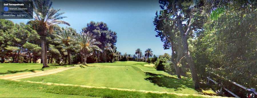
Always wanted to design Golf Torrequebrada on the costa Del sol go past it most days when on Hols there. Have to look at the tutorial to see how and if its possible to download it, always very complicated to me this lidar stuff. Thanks for a great post. Just an update it's an amazing plot of land there not sure if i have got the time or desire to spend 200-300 hours to design it but it came out wonderful.  |
|
|
|
Post by paddyjk19 on Oct 31, 2022 16:03:11 GMT -5
Always wanted to design Golf Torrequebrada on the costa Del sol go past it most days when on Hols there. Have to look at the tutorial to see how and if its possible to download it, always very complicated to me this lidar stuff. Thanks for a great post. Just an update it's an amazing plot of land there not sure if i have got the time or desire to spend 200-300 hours to design it but it came out wonderful.  When doing Chad's tool tick the box "remove cliffs" in the box on import feature - it basically continues the land from the edge of the mask based on the last height so removes those drop offs intelligently, if you find they become visible in play. A serious looking bit of land that! |
|
|
|
Post by lessangster on Oct 31, 2022 18:56:37 GMT -5
Always wanted to design Golf Torrequebrada on the costa Del sol go past it most days when on Hols there. Have to look at the tutorial to see how and if its possible to download it, always very complicated to me this lidar stuff. Thanks for a great post. Just an update it's an amazing plot of land there not sure if i have got the time or desire to spend 200-300 hours to design it but it came out wonderful.  If you had traced the course on a website called Openstreetmap it would have dragged the holes in with the data, you trace the greens fairways bunkers roads buildings in openstreetmap |
|
|
|
Post by BaconJunkie1 on Oct 31, 2022 19:50:43 GMT -5
Thanks Bullete for taking to time to do this How To for us!
If you go to that site using Google Chrome, Google Translate kicks in (or it did for me, you may have to turn that on in the settings)and asked if I wanted to covert the pages to English, it's not perfect but does help somewhat.
|
|
|
|
Post by yeltzman on Nov 1, 2022 3:52:31 GMT -5
Every Course i have ever designed always removed the fairways,greens,bunkers,Tees,cart paths from the import i always feel the tracing never matches the real course data due to the blending of the game, it's maybe why it takes me so long to design them.
Just tried that latest lidar version of Chambers bay in 2k21 Same problem there the tracing does not match the course real shame.
Going to have a look at a few lists later on spain see what the top rated courses are there, seems a great lidar site this one for spain.
|
|
|
|
Post by yeltzman on Nov 1, 2022 5:01:34 GMT -5
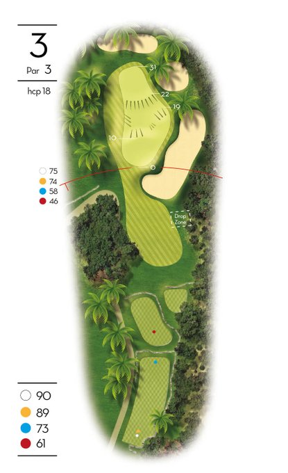
Amazing website at Golf TorreQuebrada link
Just a shame i thought it was a longer course i think Seve played there as well in the 1977 Spanish open Fantastic course guide with green info and an amazing google earth pic all over the course.   |
|
|
|
Post by BaconJunkie1 on Nov 1, 2022 8:28:43 GMT -5
I just looked at Chambers Bay (WA) and the spine work there is terrible (being nice) and a course brought in using it will never look even half-way decent. Whoever DeVietor & Spaghetti Monster are they need to go watch the LiDAR 101 video again. Any item on OSM that has been tagged to Multipolygon like the one shown below will not show up in Chad's. As far as I know there is no way to remove that tag from the item and leave the item usable (deleting the tag converts areas to lines). The only way that I've found and used is to delete the item and re-spline it and I have to warn you, the OSM peeps will not like you doing that and may give you a short vacation or drop you a nasty letter and revert the work you did there and on other courses too, again if you do it, do it all in one sitting and quickly ... Don't ask me how I know. If you decide to do that, I'd make a 2nd OSM account using a free email account just for use there and do the work. They've been pretty lax here lately, maybe they are finally seeing that work "some of us" are doing there is better than the previous work. Long story, short version, if your OSM work is bad and if you do not know how to shift terrain in Chad's so that the terrain is sitting on the LiDAR data correct, your course will be junk because bunkers, greens, etc ... will not be sitting where they belong. The easiest way to recognize a Crapdar course is to go look at a bunker or several of them with a tongue/finger in it and see how the terrain is sitting on it.  |
|
|
|
Post by kaptinkenny on Nov 1, 2022 9:15:24 GMT -5
Hi there. I'm trying to get the data for Desert Springs Golf Club near Cuevas del Almanzora. This is the file that results from the download - descarga_LIGW226375707.jnlp I followed your instructions but have had the same result twice. Any tips please? Gracias amigo. Ken Ignore me. I've worked it out
|
|
|
|
Post by kaptinkenny on Nov 1, 2022 9:16:46 GMT -5
Thanks Bullete for taking to time to do this How To for us! If you go to that site using Google Chrome, Google Translate kicks in (or it did for me, you may have to turn that on in the settings)and asked if I wanted to covert the pages to English, it's not perfect but does help somewhat. On the top right of the page there are greetings in Spanish, English and French. Click on Welcome to have the site in English. |
|
|
|
Post by lessangster on Nov 1, 2022 9:23:53 GMT -5
Now if we could just get the Lidar data into Xbox I might do some again I hate working in my laptop.
|
|
|
|
Post by yeltzman on Nov 1, 2022 9:34:36 GMT -5
Don't like doing this because its about Spanish courses but another i ripped up the fairways,greens and tees got about 60% of the bunkers done before i got bored then just made it playable for me.....Chambers bay.In the End now 99% who have brought this product in 2k21 or 2k23 have no idea about courses so does it make a difference going the extra bit to get it right not really in the end.  |
|
|
|
Post by yeltzman on Nov 1, 2022 9:36:20 GMT -5
Anybody know if there are any decent links courses in Spain, not spotted any in my search.
|
|
|
|
Post by lessangster on Nov 1, 2022 9:40:42 GMT -5
Every Course i have ever designed always removed the fairways,greens,bunkers,Tees,cart paths from the import i always feel the tracing never matches the real course data due to the blending of the game, it's maybe why it takes me so long to design them. Just tried that latest lidar version of Chambers bay in 2k21 Same problem there the tracing does not match the course real shame. Going to have a look at a few lists later on spain see what the top rated courses are there, seems a great lidar site this one for spain. If you trace them accurately it should be ok but you do know openstreetmap has a few maps on it and some of them are offset slightly from each other. Probably the reason why the bunkers and stuff don’t match exactly. On the courses I created I went in and adjusted all the splines in the designer if I could see they weren’t accurate. |
|


