|
|
Post by gamesdecent on Mar 11, 2019 19:53:17 GMT -5
chadgolfIf I already have Sweetens Cove completed, can I import the LIDAR in to the course file with planting and surfacing stuff already done? If I don’t import the OSM stuff, do I just use the shift boxes to match the LIDAR pic with the course preview pic until everything overlaps? Is it pretty unlikely to load up if the plant meter was almost full already?
|
|
|
|
Post by chadgolf on Mar 11, 2019 20:01:31 GMT -5
chadgolf If I already have Sweetens Cove completed, can I import the LIDAR in to the course file with planting and surfacing stuff already done? If I don’t import the OSM stuff, do I just use the shift boxes to match the LIDAR pic with the course preview pic until everything overlaps? Is it pretty unlikely to load up if the plant meter was almost full already? Sweetens is verrrrry small, so it'll likely fit if you mask well. As long as things are aligned to North, you should be able to just shift things around. I would recommend importing just the terrain, masking it well. Separate the terrain into a sweetens.npy file. Then take your existing course file, separate the terrain into a garbage.npy file. Now import the sweetens.npy terrain file and do a rough terrain shift to get it to match up. Now check your resource bar. If you're okay, go back and keep terrain shifting until you're happy. Don't forget to replace my name since you'll take responsibility for doing justice to the course.  And if you do run into resource bar usage, you can send me the course and I'll see if there's any internal magic I can do to save some resources. |
|
|
|
Post by gamesdecent on Mar 11, 2019 20:38:24 GMT -5
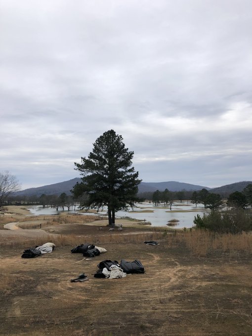
Hahaha. Are you familiar with Sweetens' flood plain issue? Where TVA closes the dam a few miles away and the whole course floods and has to close for days/weeks at a time? I'm going to take a guess and say the LIDAR was done a day it was flooded because a couple greens on the edge are perfect, but the entire interior of the course is flat as a pancake. jwfickett   |
|
|
|
Post by jwfickett on Mar 11, 2019 20:49:28 GMT -5
i am AUDIBLY FROWNING
|
|
|
|
Post by chadgolf on Mar 11, 2019 20:50:09 GMT -5
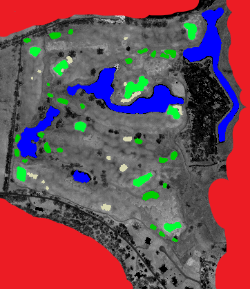
Hahaha. Are you familiar with Sweetens' flood plain issue? Where TVA closes the dam a few miles away and the whole course floods and has to close for days/weeks at a time? I'm going to take a guess and say the LIDAR was done a day it was flooded because a couple greens on the edge are perfect, but the entire interior of the course is flat as a pancake. jwfickett   OH NO! I thought we FINALLY lucked out and got lidar in 2015/2016 just after it opened and was great. Which areas do you see missing? I saw the Himalayas and most of the bunkers had impressions that were in the right places. A lot of their bunkers are enhanced with post or grass. I'll check the lidar, it can't see water very well and shouldn't have classified as ground. I only know the course from No Laying Up and their videos, so I was aware of the flooding. I know what dates the lidar was taken, so maybe I can find if it was flooded. ---- Looking at my Mask, I see a lot of detail so it shouldn't have been flooded. I used 2038253NE, 2038261SE, and 2052261SW to generate my mask.  |
|
|
|
Post by gamesdecent on Mar 11, 2019 21:13:19 GMT -5
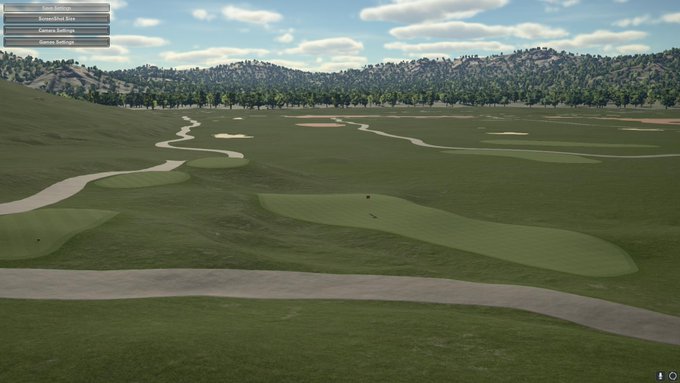
Yeah, that's what my mask looks like:  If you want to PM me your email I can send you the course file. Or if you want to try and pull in what I put in OSM with your LIDAR files and see if it works any better? If LIDAR should see through water it doesn't really make sense. In your mask I can see the shading on #8 green which is a 5-6' swale running through the center, so it should look like this:  And you can actually see the 2 shelves above the water in the flooded pic I posted, but the whole interior is flat outside of a few bumps here and there. Maybe sand piles during construction? I don't know, I was thinking Sweetens didn't open until 2016 for some reason, but I see 2014 online in places too. |
|
|
|
Post by chadgolf on Mar 15, 2019 3:19:29 GMT -5
gamesdecent I found the issue. It wasn't flooded, but I virtually flooded it. There was a bug where the very lowest parts of the course might become flattened as if they were masked, despite NOT being masked by the user. Sweetens is mostly its own flood plane, so it was almost entirely affected by this bug. Looks great now. Could you try the new release and let me know what you see? tgctours.proboards.com/thread/18416/new-testing-release-2
|
|
|
|
Post by gamesdecent on Mar 15, 2019 6:58:51 GMT -5
You the man, Chad!
I’m going out of town this weekend, but I’ll definitely see what I can do with it when I get back.
|
|
|
|
Post by gamesdecent on Mar 19, 2019 21:34:39 GMT -5
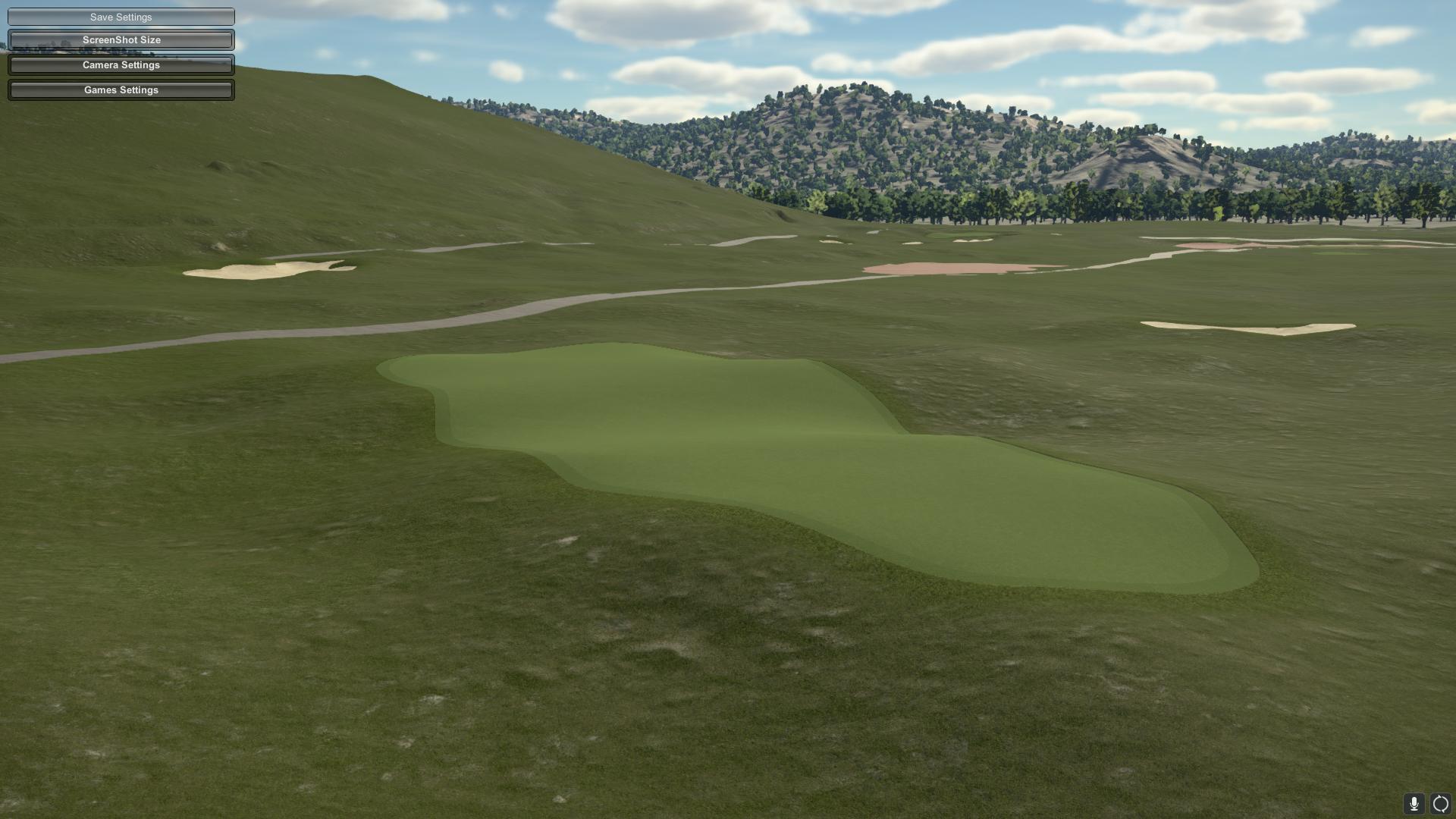
Uh oh.  |
|
|
|
Post by chadgolf on Mar 24, 2019 20:39:20 GMT -5
What's the issue here? Do you think the "tricked out" this green later after the lidar was taken?
The rest of the data is looking much better.
|
|
|
|
Post by gamesdecent on Mar 24, 2019 20:52:15 GMT -5
No I think the LIDAR is spot on now.
|
|
|
|
Post by gamesdecent on Apr 8, 2019 19:49:46 GMT -5
|
|
|
|
Post by jwheels9876 on Apr 8, 2019 20:02:58 GMT -5
I'm putting one right through one of those windows  Looks great |
|