teeofftowersey
Weekend Golfer
 The good news is we have found the ball. The bad news is we have found the ball.
Posts: 84  TGCT Name: Lawrence Towersey
|
Post by teeofftowersey on Apr 19, 2023 2:54:46 GMT -5
Is it possible to replicate UK courses using LiDAR data?
The YouTube videos I have found only seem to use the USGA site.
|
|
|
|
Post by yeltzman on Apr 19, 2023 5:56:02 GMT -5
Just a personal view i find the UK data much better than the US site.....(but i am very biased) not a new website been there at least the last 3-4 years that site. Just need to use the Lidar point cloud data, the newer the data the better it is.Just make sure you mask your course as good as you can, because 2k23 uses a hell of alot of the object meter with links terrain. I find you still need to do a lot of work to the course to make it playable for 2k23 play, but all the terrain detail is there. Royal st Georges a good example to compare terrain.   |
|
teeofftowersey
Weekend Golfer
The good news is we have found the ball. The bad news is we have found the ball.
Posts: 84
TGCT Name: Lawrence Towersey
|
Post by teeofftowersey on Apr 19, 2023 11:25:47 GMT -5
Thanks Yeltsman, I presume you follow the tutorials using the USGA site but substitute the UK gov site instead. I am also assuming the zipped download of LiDAR data has to be unzipped and placed in the course folder being worked on?
|
|
|
|
Post by yeltzman on Apr 20, 2023 6:20:40 GMT -5
I know different people design them different but when you look how the game does blending with bunkers i find just as quick to use the terrain and just place the bunkers,tee,fairways,greens down,i reckon around 30mins for the 1st hole plus you got the exact positions of the houses.  |
|
|
|
Post by chatgptgolfklubber2.0 on Apr 20, 2023 21:47:43 GMT -5
Where did you find that pic yeltzman? That's what I'm talking about. If I could ever play there, after the round, just bury me on the highest dune, closest to the beach and the sunset. |
|
|
|
Post by chatgptgolfklubber2.0 on Apr 20, 2023 21:48:17 GMT -5
Crazy how accurate the photos compare too.
|
|
|
|
Post by yeltzman on Apr 21, 2023 2:51:14 GMT -5
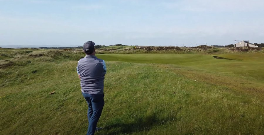
Crazy how accurate the photos compare too. That's the difference between Lidar and Non Lidar designs just the accuracy of the terrain, I was a massive sceptic of lidar when it came out but once you used lidar terrain really its tough to go back to the old method. Only problem is in 2k23 it uses so much of the object meter you lose the quality of the design compared to 2k21 that's why it really is better to design the old method because really only a small percentage of players really know the difference. The Picture was from the Royal St George's Twitter account, How the course looked in 2k23 a few weeks ago,with the 2021 pin positions and stands if you want the course in the game let me know ill get it in over the weekend.PS been saying it from tgc1 days when you compare the lighting in EA's game 2k's game needs better lighting overall |
|
|
|
Post by chatgptgolfklubber2.0 on Apr 21, 2023 11:33:32 GMT -5
Absolutely need RSG in the game mate.
Best course in England IMO.
|
|
|
|
Post by yeltzman on Apr 23, 2023 13:14:39 GMT -5
|
|
|
|
Post by slippymcdippy on May 1, 2023 10:28:16 GMT -5
Trying to give this a whirl, but the request for mapquest api is invalid?
|
|
|
|
Post by yeltzman on May 2, 2023 2:18:46 GMT -5
Are you using chad's golf programme 0.3.3 the new version.
|
|
|
|
Post by slippymcdippy on May 2, 2023 10:14:19 GMT -5
oh theres a new one?
|
|
|
|
Post by slippymcdippy on May 2, 2023 11:08:52 GMT -5
well that solved that. thank you
|
|
teeofftowersey
Weekend Golfer
The good news is we have found the ball. The bad news is we have found the ball.
Posts: 84
TGCT Name: Lawrence Towersey
|
Post by teeofftowersey on May 6, 2023 13:38:32 GMT -5
Is there a good guide on how to elevate the terrain surrounding a Lidar plot. The trick is how not to interfere with the edges of the lidar produced terrain. Any ideas please would be appreciated.
|
|
teeofftowersey
Weekend Golfer
The good news is we have found the ball. The bad news is we have found the ball.
Posts: 84
TGCT Name: Lawrence Towersey
|
Post by teeofftowersey on May 6, 2023 14:27:46 GMT -5
What I have found is that by using a square flattening brush (from page 1 of the brushes) to the desired width and raising it by say 20' click the surrounding area multi times until you get close to the existing Lidar terrain height. Then select a circular brush and using a small foortprint and kept @ 0' flatten the Lidar terrain by working outwards and gradually lift the lower terrain. This seems to work well although very time consuming.
|
|